
NASA scientists observe this trend to enhance weather forecasting and understand how global warming affects Earth.
NASA offers this free real-time satellite map which allows users to explore over 1000 global, full-resolution satellite imagery layers interactively and download their respective data sets, along with information regarding natural events and hazards.
Real-time Updates
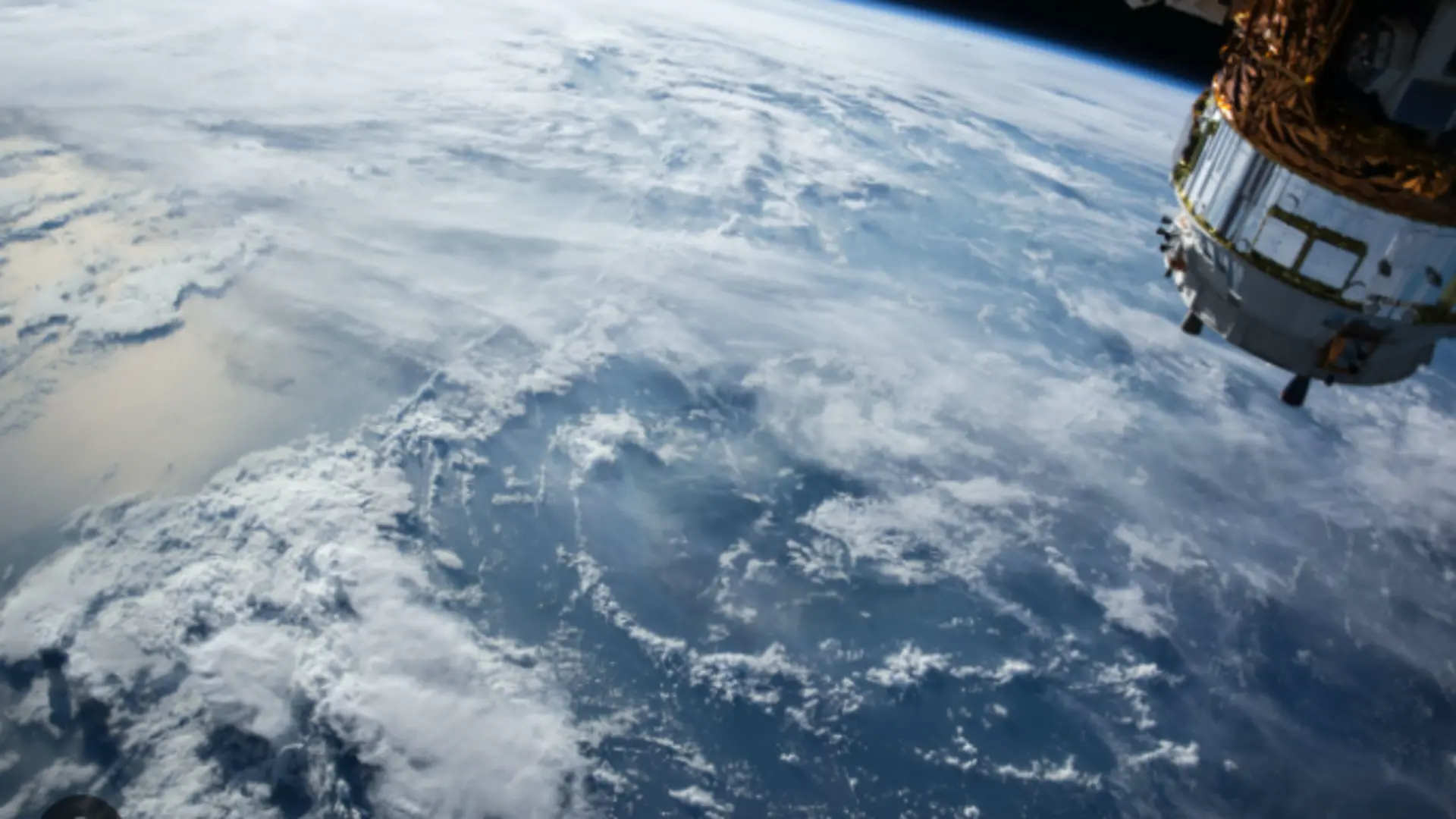
Satellites offer us an unmatched view of Earth from above. Their images reveal fires in forests, monitor algae blooms and reveal new details about ice sheets and glaciers – helping us gain greater insight into how Earth operates as well as predicting potential changes to come.
More: The Museum of Discovery | The Colorado History | Fayettevilla Museum | Dupont Museum | Washington DC Local T.V Station | Survey Monkey Quiz Mode | New Politics Academy
NASA provides scientists and the public with several online tools for accessing real-time satellite images, aerial views and weather forecasts. Their Worldview application enables users to interact with global satellite imagery within hours of being acquired – saving and sharing what they find while downloading its associated data.
Zoom Earth, a Bing-style web app, shows satellite and aerial views in an easily navigable map format. Zoom Earth pulls data every 10 minutes from NOAA GOES satellites as well as JMA Himawari-8 satellites operated by Japan Mapping Agency Himawari-8 and every 15 minutes from EUMETSAT meteorological satellites; in addition to current imagery it also features storm tracker capabilities as well as nighttime conditions around the globe.
Collect Earth Online (CEO) is a free, open-source system designed to enable users to efficiently and flexibly gather satellite data. Developed by SERVIR – a partnership of NASA, USAID, technical organizations and communities from developing countries – as part of FAO’s OpenForis initiative, it facilitates efficient data collection.
The Earth Engine Data Catalog offers a broad array of science datasets and information products, such as satellite imagers like Landsat, MODIS, ASTER and ALOS; atmospheric reanalysis data; surface emissivity gridding from NASA Earth Exchange (EX).
Climate model output from University of Idaho MACAv2-METDATA climate model simulations and downscaled climate projections from NASA Earth Exchange; historic archiveal data from over 40 years of satellite observations through NASA Earth Exchange Archive; as well as archiveal satellite observations/data sets/archival datasets/archive.
NASA’s Earth Observing System Data and Information System (EOSDIS) program manages data from past and current Earth observation satellites, aircraft and field measurements; through Earthdata Search portal, scientists and the general public alike are able to explore over 33,000 datasets available from NASA EOSDIS program.
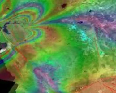
Satellite Imagery
Satellite imagery allows us to explore the beautiful terrains of Earth with astounding precision. Astronaut Edgar Mitchell described our planet as “a sparkling blue and white jewel”, but satellites give us access to its surface with unprecedented detail. Images like these allow us to monitor changes to the environment such as natural disasters, agricultural activity and human-made activities – as well as any environmental change such as natural disasters or human-caused activities that occur on it.
There are various providers offering free satellite images such as NASA Worldview and EO Browser as well as public sources like Copernicus Data Space Ecosystem or INPE Catalog which provide free satellite images in incredible detail for study or research purposes.
Worldview is an open platform that enables users to search for and browse satellite images worldwide. Updated near real-time, Worldview is easily accessible on desktop computers, tablets and smartphones and features an easy browsable interface making finding images of interest simple while searching by date/time can reveal changes over time.
EO Browser is an intuitive web service that makes medium-resolution satellite imagery easily available for free, offering analysis and visualizing data it displays. With ready-made band combinations designed to highlight vegetation health, urban area or water issues – as well as creating time series of a specific area – this website allows access to medium-resolution imagery as well as individual bands comprising it for download.
USGS and Sentinel Hub offer other free satellite images. While one offers Landsat and Sentinel-2 imagery, both provide wide variety of satellite images for download as jpeg or tif formats with additional options like color correction. Tif images tend to provide greater detail while being harder to access when downloading.
NASA Scientific Visualization Studio creates visualizations, animations and images that promote a deeper understanding of Earth and space sciences. Working in conjunction with NASA scientists as well as scientists outside their organization, this program collaborates on producing high-quality data-backed visualizations which can be used to educate students about Earth and space sciences; or as teaching aids when teaching about orbits or remote sensing. Their website features videos and animations.
Weather Forecasts
By looking at satellite data, it’s easy to gain an instantaneous snapshot of Earth’s weather. This includes cloud cover, surface temperature and wind speed – data used by meteorologists for creating forecasts and reports on everything from floods to hurricanes.
Not only can spacecraft monitor atmospheric conditions, they can also track changes in water supply and ocean currents. Satellites use this data to track ozone layer depletion as well as environmental issues – one of the first satellites ever launched was used to track massive oil fires in Kuwait during 1991!
Information collected by weather satellites is utilized by various government agencies for policy development and decision making purposes, including disaster management. For instance, satellites can help monitor forest fires to provide essential details necessary for firefighters to contain them as well as being used by hydrologists to track snowpack levels essential for runoff in western US areas.
Tracking the movement of ice is another effective satellite tool, essential for shipping and navigation.
The GOES-R satellite will send back images every 30 seconds back to Earth, enabling forecasters to identify storm development quickly and accurately, capture more detailed information about sun activity through its magnetometer onboard the satellite, as well as detect magnetic fields around Earth as well as solar flares which could disrupt power grids on earth or interfere with satellite and radio systems or even affect people in space.
As well, smartphones and tablet apps offer additional ways of monitoring weather. One such application, Ventusky, provides real-time views of Earth with near real-time satellite layers from various sources and forecasts based on model output. Other apps such as PlanetScope utilize hundreds of nanosatellites with sensors on them to create images daily of our planet.
Interactive Maps
GIS (Geographic Information System) is an information organization and analysis system. Its applications range from weather forecasting to mapping specific geographical features; first responders and disaster relief agencies often utilize GIS during times of crisis for timely updates on incident relief efforts; it also has several uses for everyday users ranging from environmental monitoring to finding their way around town.
See More: The Museum of Discovery | The Colorado History | Museum Northwest | Flagstaff Museum | Terry Bryant Accident Injury Law | Nevada Museum
There are various satellite maps available online; some are free while others require registration or payment. One popular choice is Google Maps, with its huge database and regular updates in populated areas. Bing Maps also has a comparable database and user-friendly interface providing satellite views.
NASA provides interactive maps, including one from their Surface Water and Ocean Topography (SWOT) mission that offers insight into changes to global sea level trends as part of addressing climate change.
State of the Ocean application from Physical Oceanography DAAC can also prove invaluable. With it you can compare various NASA products in an easy web map application and easily communicate Earth’s ocean status while conducting scientific research.
These apps use different processing techniques to display Earth’s surface. Some utilize raw satellite imagery while others combine various spectral channels into one image to represent its appearance to human eyes under visible light conditions.
GeoColor images created with data sourced from both GOES East and GOES West satellites (which orbit at 75.2 degrees and 137.2 degrees West longitude respectively, and cover the Western Hemisphere from Africa to North America) combine their views into one composite picture.
These apps provide stunning imagery, but their pictures only represent snapshots in time. To see the latest satellite image of any specific area, it is best to utilize NOAA Satellite Maps Page instead. This site displays updated images frequently.